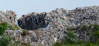
Today we are aware of the number of actions that has to be taken when a landfill is to be closed and filled over, but this has not always been the case.
As cities grow old landfills that used to be far from urban areas may now be close to cities, or even within them. On the surface of the old landfill everything appears to be fine, but beneath it lies buried waste that might be causing serious environmental problems. Many closed landfills were just filled and covered with soil and then left as they were.
Old landfills often have high concentrations of heavy metals, nutrients and organic substances in the ground and, as they seldom were constructed with containment as an objective, they risk polluting both surrounding groundwater and downstream surface water. For environmental protection and land re-use purposes there are therefore a number of issues that needs to be investigated and considered, e.g. how much waste is buried, at which depth is it located and the status of soil covers.
Waste may have a high variation of resistivity
Resistivity imaging is a method which is great for mapping the geological and hydrogeological properties of the ground, but as waste may have a high variation of resistivity, it can be difficult differentiating waste from the surrounding soil by only doing resistivity measurements. Buried waste and leakage from it often have a high concentration of ions resulting in high chargeability.
Visit the company website to read more in Application note – How to map waste deposits using resistivity and IP.
Image: What happens beneath ladnfills. Photo: courtesy fof ABEM.
